Просмотр новости
Найдите то, что Вас интересует
 Спутники
 РН
РН SpaceX
 Роскосмос
 NASA
NASA
СпутникиРНSpaceXРоскосмосNASALarge-scale tidal observations challenge the textbook idea that two symmetric water bulges physically form on opposite sides of Earth. For generations, students have learned to picture Earth’s oceans forming two broad bulges on opposite sides of the planet under the Moon’s gravitational influence. Researchers led by Yongfeng Yang of the Water Resources Comprehensive Development Center [...]
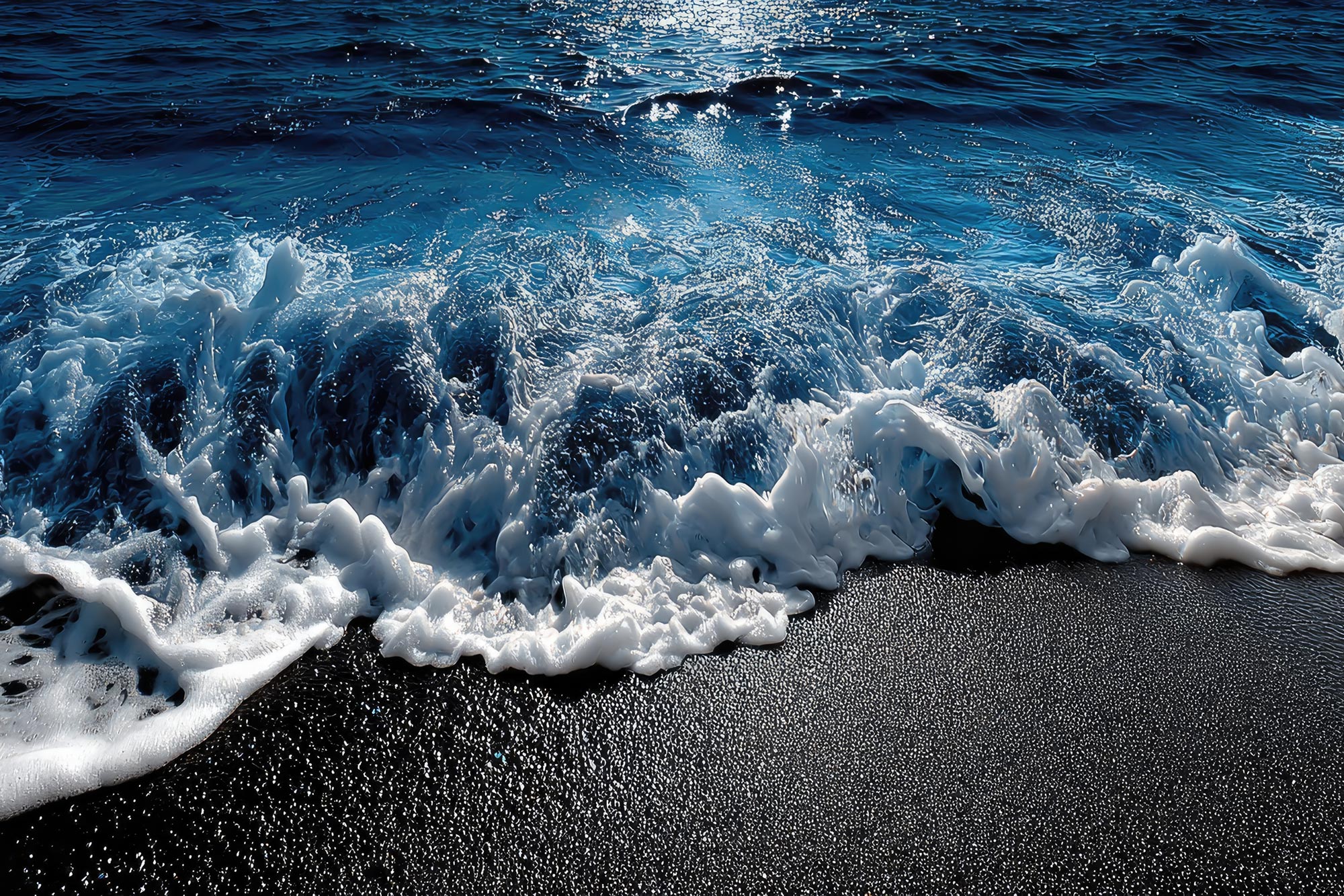 A global analysis of satellite and tide-gauge measurements found that high and low tides often occurred where the familiar two-bulge model predicts the opposite. Credit: Shutterstock
Large-scale tidal observations challenge the textbook idea that two symmetric water bulges physically form on opposite sides of Earth.
For generations, students have learned to picture Earth’s oceans forming two broad bulges on opposite sides of the planet under the Moon’s gravitational influence. Researchers led by Yongfeng Yang of the Water Resources Comprehensive Development Center of Shandong Province, Jiajia Yuan of the School of Geomatics at Anhui University of Science and Technology, and Mingyuan Fan of the Water Resources Research Institute of Shandong Province have now tested whether those proposed bulges actually appear on Earth’s surface.
The question reaches back to the 18th century and concerns the double water bulge model, a familiar explanation of tides in physics, oceanography, and geography textbooks.
According to the classical model, the Moon’s gravity produces two symmetric water bulges on opposite sides of Earth. As Earth rotates, a location is expected to move through these raised regions and experience high tide, then through lower regions and experience low tide. Versions of this explanation also appear on websites maintained by institutions including NOAA, National Geographic, and NASA.
Satellite data challenge the bulge modelTo test the prediction directly, the researchers analyzed tidal observations from 362,370 ocean locations measured by the Jason-3 satellite of AVISO throughout 2021. They compared occurrences of high and low tide with lunar angle, defined as the angle between a given location and the Moon relative to Earth’s center.
Among 175,402 locations falling within lunar angles of 0°–60° and 120°–180°, the regions where the model predicts water bulges, 56.84% experienced low tides and 43.16% experienced high tides. The opposite pattern appeared among 186,968 locations in the 60°–120° range, corresponding to the model’s depressed water region, where 56.38% experienced high tides.
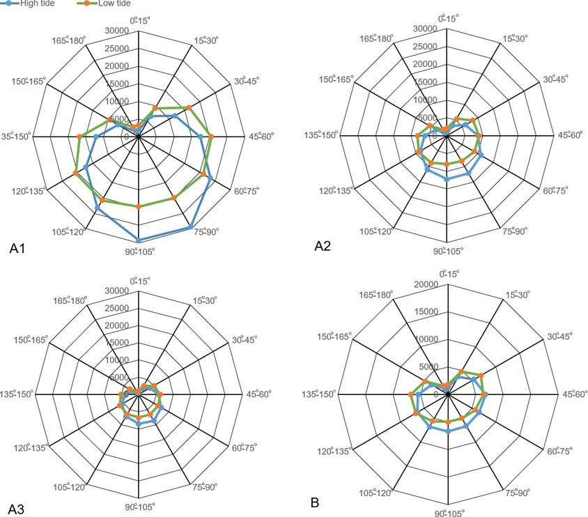 (A1) Global pattern derived from satellite altimetry. (A2) Pacific Ocean pattern. (A3) Atlantic Ocean pattern. (B) Pattern derived from 166 tide-gauge stations. In the polar plot, the radial axis denotes the number of observed high- or low-tide events, and the radial sectors indicate the lunar angle in degrees. Credit: Science China Press
“The findings directly contradict the physical existence of two water bulges on the Earth’s surface,” the authors state. The researchers also examined observations from 166 tide-gauge stations during August 2014 and found the same overall pattern: low tides occurred predominantly at lunar angles of 0°–60° and 120°–180°, while high tides were more common between 60° and 120°.
Tide gauges show the same patternResearchers studying tides have long questioned whether two physical water bulges can actually form because real oceans are strongly affected by landmasses, the shape of ocean basins, the Coriolis force, and friction with the seafloor. According to the study authors, however, that skepticism had remained largely theoretical (oral), without direct observational evidence demonstrating the discrepancy.
The study also discusses a recently proposed alternative in which tides arise from oscillations of ocean basins rather than from seawater simply being pulled into two bulges. Under this view, the Moon’s gravity deforms the solid Earth, and as the elongated Earth rotates, ocean basins are repeatedly raised and lowered, driving water movement that produces daily cycles of high and low tides.
This “solid Earth deformation drives seawater to move” mechanism is consistent with the reported observations: low tides occur more often where the solid Earth rises upward (creating shallower water), while high tides occur more often where it is compressed (creating deeper water).
Reference: “Testing the physical reality of tidal bulges in the world’s oceans” by Yongfeng Yang, Jiajia Yuan and Mingyuan Fan, 20 May 2026, Science China Earth Sciences.
DOI: 10.1007/s11430-025-1878-3
Never miss a breakthrough: Join the SciTechDaily newsletter.
Follow us on Google and Google News.
| # | Наименование новости | Тональность | Информативность | Дата публикации |
|---|---|---|---|---|
| 1 | A Key Atlantic Ocean Current Did the Opposite of What Scientists Expected | 0 | 17.18 | 12-08-2026 |
| 2 | NASA Satellite Captures First-Ever High-Res View of Massive Pacific Tsunami | 5 | 7 | 01-05-2026 |
| 3 | Scientists Just Found a Hidden Factor That Could Trigger an Atlantic Ocean Collapse | 0 | 17.48 | 17-09-2026 |
| 4 | The Indian and Pacific Oceans Are Falling Out of Sync | 0 | 17.63 | 16-09-2026 |
| 5 | A Crucial Atlantic Current Is Weakening and Weather Could Change Worldwide | -1 | 7 | 15-05-2026 |
| 6 | Humanity’s Carbon Signature Is Now Embedded Deep in the Ocean | 0 | 18.71 | 01-09-2026 |
| 7 | The Mediterranean Isn’t Safe: Scientists Warn of Inevitable Tsunami | -2 | 7 | 30-03-2026 |
| 8 | 🌙 А ЕСЛИ ЗЕМЛЯ НИКОГДА НЕ БЫЛА ОДНА? Представьте, что ... | 0 | 6.94 | 12-08-2026 |
| 9 | The Sea Is Higher Than We Thought and Millions More Are at Risk | 0 | 11.9 | 04-03-2026 |
| 10 | High-resolution mapping of wave energy resources in the Mediterranean Sea using satellite altimetry | 0 | 6.15 | 31-12-2025 |